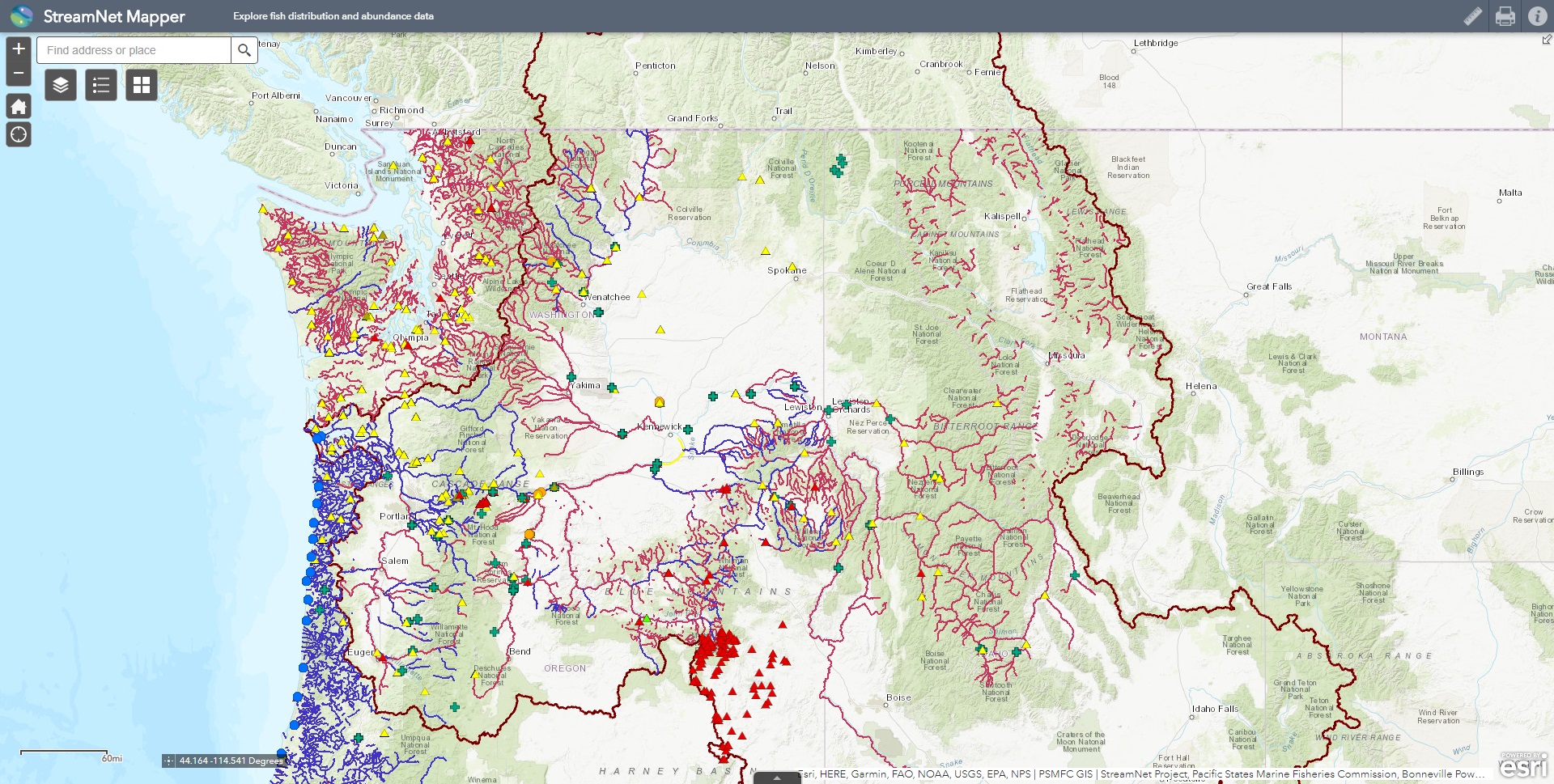
StreamNet Mapper
 Explore fish distribution and sampling locations.
The data represented in this application vary in age, accuracy, scale, completeness, and extent of coverage, and have been contributed from various sources. We highly recommend reviewing available metadata prior to interpreting these data. The GIS layers metadata are available here. If more information is needed about the underlying data sets, please contact us.