
CHaMP
StreamNet provides access to these Columbia Habitat Monitoring Program (CHaMP) documents and data sets in support of the Bonneville Power Administration (BPA) funded Northwest Power and Conservation Council’s (NPCC) Columbia River Basin Fish and Wildlife Program (FW-Program).
In 2018, the CHaMP project was phased out following an NPCC recommendation. The extensive volume of documents and datasets from ESA/Sitka’s champmonitoring.org are being archived by StreamNet as these are received from ESA and made accessible from this webpage.
NPCC memos related to CHaMP and final recommendations on CHaMP:
- View project description and funding history of the CHaMP (Project # 2011-006- 00)
- NPCC staff June 6, 2017 memo summarizing Council recommendations and information about CHaMP
- NPCC Research Decision Letter to BPA from December 18, 2018 (see document table below for letter)
For additional details
- Jump to CHaMP Data File Explorer documents
- Jump to table of Additional CHaMP Documents
- View CHaMP metrics on the NOAA InPort https://www.fisheries.noaa.gov/inport/item/18087
- Access CHaMP microsite maintained by ESA https://www.champmonitoring.org/
CHaMP and BPA/NPCC FW Program
The CHaMP project was funded as a pilot project by BPA between 2011 and 2017 to assess if it could help address the requirements of the 2008 Federal Columbia River Power Supply (FCRPS, now CRS) BiOp and RPA 56.3 (see BPA Project 2011-006-00).
It was proposed by the Integrated Status and Effectiveness Monitoring Program (ISEMP BPA Project 2003-017-00) and eight collaborating agencies to provide information on the status/trends in habitat conditions, and support habitat restoration, rehabilitation and conservation actions, performance assessments, and the adaptive management requirements of the 2008 FCRPS BiOp.
The pilot was evaluated on a yearly basis and after the review in 2018, the pilot was discontinued.
Background
The 2008 Biological Opinion (BiOp) on the Federal Columbia River Power System (FCRPS) identified implementation of tributary habitat restoration projects as a means to offset mortality imposed by the FCRPS on anadromous salmonids. In 2010, the Bonneville Power Administration (BPA) began development of the Columbia Habitat Monitoring Program (CHaMP) to meet FCRPS Action Agency prescriptions for habitat monitoring (FCRPS BiOp RPA 56.3). The BPA worked with the National Oceanic and Atmospheric Administration (NOAA) and other regional fish management agencies to implement CHaMP.
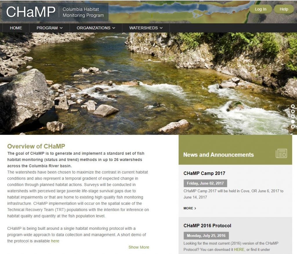
The goal of CHaMP was to generate and implement a standard set of fish habitat monitoring (status and trend) methods in up to 26 watersheds across the Columbia River basin. The watersheds were chosen to maximize the contrast in current habitat conditions and also represent a temporal gradient of expected change in condition through planned habitat actions. Surveys were conducted in watersheds with perceived large juvenile life-stage survival gaps due to habitat impairments or that are home to existing high quality fish monitoring infrastructure. CHaMP implementation occured on the spatial scale of the Technical Recovery Team (TRT) populations with the intention for inference on habitat quality and quantity at the fish population level.
CHaMP was built around a single habitat monitoring protocol with a program-wide approach to data collection and management. The protocol is fish-centric, i.e., it measures habitat relevant to salmonids of interest under the BiOp. The CHaMP protocol is structured around a general understanding of the link between habitat attributes and specific life history requirements of salmonids managed under the 2008 BiOp. These fish are likely not only responding to watershed and reach conditions, but also to the conditions of individual channel units within reaches. Accordingly, the CHaMP protocol has been developed to capture habitat features that drive fish population biology.
CHaMP methods draw from many existing protocols as well as novel approaches to collecting and analyzing channel geomorphological data. The protocol is designed to maintain the rapid nature of existing stream habitat protocols, and to collect data within a geomorphological hierarchy spanning multiple spatial scales, i.e., within-channel unit, channel unit, geomorphic reach, watershed and subbasin scales. The protocol employs spatially continuous sampling strategies to conduct precise topographic surveys from which digital elevation models (DEMs) can be produced. These topographic surveys are augmented by other data (e.g., channel classification, fish cover, substrate composition, distribution and embeddedness, large woody debris, solar input and water temperature, stream discharge, water chemistry, riparian structure, and site-level human influence) that help to characterize aspects of channel units that influence site-scale fish production potential.
CHaMP data were used to evaluate the quantity and quality of tributary fish habitat available to salmonids across the Columbia River basin in wadeable, perennial streams below natural impassible barriers within TRT population boundaries. The stream habitat data generated by CHaMP were intended to be used in conjunction with salmonid growth, survival, abundance and productivity data to estimate fish-habitat relationships and assess the impact of habitat management actions on fish population processes across the Columbia River Basin. In addition to meeting FCRPS BiOp prescriptions (RPA 56.3), CHaMP supports habitat restoration, rehabilitation, and conservation action performance assessments and adaptive management requirements of the 2008 FCRPS BiOp.
CHaMP Protocol Documentations
All protocols developed and applied by CHaMP, including versions adjusted for the sampling years 2011 to 2019 are maintained in MonitoringResources.org. Hyperlinks are provided below:
CHaMP- Scientific Protocol for Salmonid Habitat Surveys within the Columbia Habitat Monitoring Program (CHaMP)
BPA MBACI Monitoring Effectiveness of Instream Habitat Projects (Bank Stabilization) v1.0
Organizations Participating in CHaMP and staff participating as of 2019
California Department of Fish and Wildlife
People
Crew Supervisor
- Sean Gallagher
- Elizabeth Mackey
Watersheds
Go to the Watersheds section of the ESA maintained CHaMP website for additional details including study design, field support, visits, measurements, metrics, characteristics, status, people and organization
- Big-Navarro-Garcia (CA)
- CHaMP Training
Crew Leader
- Christopher Clark
Watersheds
Go to the Watersheds section of the ESA maintained CHaMP website for additional details including study design, field support, visits, measurements, metrics, characteristics, status, people and organization
- John Day
- Tucannon
Columbia River Inter-Tribal Fish Commission
Crew Supervisor
Monica Blanchard
Lauren Burns
Casey Justice
Dale McCullough
Seth White
Crew Leader
- Monica Blanchard
Danielle Horn
Crew Member
- Danielle Horn
- Kristi Olney
- Nancy Platt
- Lindsay Powell
Watersheds
Go to the Watersheds section of the ESA maintained CHaMP website for additional details including study design, field support, visits, measurements, metrics, characteristics, status, people and organization
- CHaMP Training
- Upper Grande Ronde
Confederated Tribes of the Umatilla Indian Reservation
Crew Supervisor
- Ken Burcham
- Kaylyn Costi
- Leslie Naylor
- Gene Shippentower
Crew Leader
- Ken Burcham
- Craig Contor
- Kaylyn Costi
- Andrew Wildbill
Crew Member
- Ken Burcham
- Colette Coiner
- Craig Contor
- Aaron Quaempts
- Andrew Van Sickle
- Andrew Wildbill
Watersheds
Go to the Watersheds section of the ESA maintained CHaMP website for additional details including study design, field support, visits, measurements, metrics, characteristics, status, people and organization
- Asotin
- CHaMP Training
- John Day
- Tucannon
- Umatilla
- Upper Grande Ronde
- Walla Walla
Eco Logical Research
Crew Supervisor
- Steve Bennett
- Reid Camp
- Andrew Hill
- Eric Wall
- Gus Wathen
- Nick Weber
- Jacob Wirtz
Crew Leader
- Ross Gleason
Crew Member
- Devin Baumer
- Jordan Burningham
- John Deane
- Erica Gorey
- Bryan Hongo
- Alex Pitman
- Erika Winner
Watersheds
Go to the Watersheds section of the ESA maintained CHaMP website for additional details including study design, field support, visits, measurements, metrics, characteristics, status, people and organization
- Asotin
- CHaMP Training
- John Day
- Tucannon
- Upper Grande Ronde
Natural Systems Design
Crew Supervisor
- Jennifer O’Neal
- Colin Riordan
Crew Leader
- Roby Ventres-Pake
- Megan Whiteside
Crew Member
- Kaitlynn Cafferty
- Roby Ventres-Pake
- Caroline Walls
Watersheds
Go to the Watersheds section of the ESA maintained CHaMP website for additional details including study design, field support, visits, measurements, metrics, characteristics, status, people and organization
- Tucannon
Oregon Department of Fish and Wildlife
Crew Supervisor
- Christopher Horn
- Ted Sedell
- Shelley Tattam
Crew Leader
- Joshua Dowdy
- Shelley Tattam
Crew Member
- Marlene Cross
- Joshua Dowdy
- Jonathan Downey
- Drayden Farci
- Gerrish “Ben” Willis
Watersheds
Go to the Watersheds section of the ESA maintained CHaMP website for additional details including study design, field support, visits, measurements, metrics, characteristics, status, people and organization
- CHaMP Training
- John Day
- Minam
- Upper Grande Ronde
Oregon State University
Crew Member
- James Pearson
- Levi Pienovil
Watersheds
Go to the Watersheds section of the ESA maintained CHaMP website for additional details including study design, field support, visits, measurements, metrics, characteristics, status, people and organization
- Umpqua
Quantitative Consultants Inc
Crew Supervisor
- Laurel Faurot
Crew Leader
- Richie Carmichael
- Laurel Faurot
- Michelle Romportl
Crew Member
- Tulley Mackey
- oliver ott
- Michelle Romportl
- Joseph Sullivan
- molly sutton
Watersheds
Go to the Watersheds section of the ESA maintained CHaMP website for additional details including study design, field support, visits, measurements, metrics, characteristics, status, people and organization
- CHaMP Training
- Lemhi
- South Fork Salmon
- Upper Grande Ronde
Crew Supervisor
- Evelyn Galloway
Watersheds
Go to the Watersheds section of the ESA maintained CHaMP website for additional details including study design, field support, visits, measurements, metrics, characteristics, status, people and organization
- CHaMP Training
Crew Supervisor
- Matt Nahorniak
- Steve Rentmeester
- Keith Steele
Crew Member
- Matt Archibald
Watersheds
Go to the Watersheds section of the ESA maintained CHaMP website for additional details including study design, field support, visits, measurements, metrics, characteristics, status, people and organization
- CHaMP Training
Crew Supervisor
- Steve Fortney
- Crissy Hill
- Rueben Miller
- Keith van den Broek
Crew Leader
- Loren Doner
- Crissy Hill
- Jonah Keith
- Tom Koski
- Rueben Miller
- Martin Novak
Crew Member
- Becky Gehri
- Connor Osterlund
Watersheds
Go to the Watersheds section of the ESA maintained CHaMP website for additional details including study design, field support, visits, measurements, metrics, characteristics, status, people and organization
- Asotin
- CHaMP Training
- Entiat
- John Day
- Lemhi
- Methow
- South Fork Salmon
- Tucannon
- Umatilla
- Upper Grande Ronde
- Wenatchee
Crew Supervisor
- Jef Parr
Watersheds
Go to the Watersheds section of the ESA maintained CHaMP website for additional details including study design, field support, visits, measurements, metrics, characteristics, status, people and organization
- Asotin
- CHaMP Training
- Entiat
- John Day
- Lemhi
- Methow
- South Fork Salmon
- Tucannon
- Umatilla
- Upper Grande Ronde
- Wenatchee
Utah State University
Crew Supervisor
- Nathaniel Hough-Snee
- Martha Jensen
- Matthew Meier
- Geoff Stevens
Crew Leader
- Martha Jensen
- Matthew Meier
- Geoff Stevens
Crew Member
- Martha Jensen
- Matthew Meier
- Geoff Stevens
Watersheds
Go to the Watersheds section of the ESA maintained CHaMP website for additional details including study design, field support, visits, measurements, metrics, characteristics, status, people and organization
- Region 17
Crew Supervisor
- Amy Charette
- Joe Lemanski
Crew Leader
- Keith Karoglanian
- Joe Lemanski
Crew Member
- Allison Field
- Keith Karoglanian
- Wendy Neal
Watersheds
Go to the Watersheds section of the ESA maintained CHaMP website for additional details including study design, field support, visits, measurements, metrics, characteristics, status, people and organization
- CHaMP Training
- Deschutes
- John Day
Crew Supervisor
- Boyd Bouwes
- Jeremiah Heitke
- Geoff Stevens
Watersheds
Go to the Watersheds section of the ESA maintained CHaMP website for additional details including study design, field support, visits, measurements, metrics, characteristics, status, people and organization
- CHaMP Training
- Region 17
- Yankee Fork
Crew Supervisor
- Oliver Pimms
Crew Leader
- Brad Parrish
Crew Member
- Ryan Deknikker
- Nathan Longoria
Watersheds
Go to the Watersheds section of the ESA maintained CHaMP website for additional details including study design, field support, visits, measurements, metrics, characteristics, status, people and organization
- Toppenish
CHaMP Watersheds
Below are the 17 CHaMP watersheds that were included in the CHaMP pilot implementation.
For additional details, go to the Watersheds section of the Environmental Science Associates/Sitka Technology Group maintained CHaMP website which includes information on each watershed’s study design, field support, visits, measurements, metrics, characteristics, status, people and organization.
The ESU/DPS of focus in this watershed
- Snake River Spring / Summer- run Chinook Salmon ESU
- NWR Population ID – CKSNRssASO
- Snake River Basin Steelhead DPS
- NWR Name: Steelhead (Snake River Basin DPS) – Asotin Creek
- NWR Population ID – STSNRsuASO
Upper Columbia River Steelhead DPS; Upper Columbia River Spring-run Chinook Salmon ESU
Middle Columbia River Steelhead DPS
Snake River Spring/Summer-run Chinook Salmon ESU; Snake River Basin Steelhead DPS
Snake River Spring/Summer-run Chinook Salmon ESU; Snake River Basin Steelhead DPS
Upper Columbia River Steelhead DPS; Upper Columbia River Spring-run Chinook Salmon ESU
Snake River Spring/Summer-run Chinook Salmon ESU; Snake River Basin Steelhead DPS
Snake River Spring/Summer-run Chinook Salmon ESU; Snake River Basin Steelhead DPS
Snake River Spring/Summer-run Chinook Salmon ESU; Snake River Basin Steelhead DPS
Middle Columbia River Steelhead DPS
Snake River Spring/Summer-run Chinook Salmon ESU; Snake River Basin Steelhead DPS
Middle Columbia River Steelhead DPS
Upper Columbia River Steelhead DPS
Snake River Spring/Summer-run Chinook Salmon ESU; Snake River Basin Steelhead DPS
CHaMP Data File Explorer
Navigate, search, and view most CHaMP data files in a familiar folder system layout by opening the CHaMP File Explorer.
Additional CHaMP Documents
| File | Description | File Date |
|---|---|---|
| NPCC Decision Letter to BPA | On December 11, 2018 the Council completed a progress review of 25 projects engaged in research activities under the Fish and Wildlife Program. The Council’s recommendations to Bonneville regarding these projects are detailed in the attached document and summarized here. The list of project recommendation includes the NPCC recommendation to BPA on the closing out of CHaMP (BPA project 2011-006-00) | 2018 |
| TucannonSiteList_Information_20180211 | 2018 | |
| ISEMP CHaMP Combined Annual Report 2016 Draft | This report presents an update on the implementation of Bonneville Power Administration’s (BPA) Integrated Status and Effectiveness Monitoring Program (ISEMP; BPA Project 2003-017-00) and the Columbia Habitat Monitoring Program (CHaMP; BPA Project 2011-006-00) during 2016. The work conducted under ISEMP and CHaMP covers key populations within the Upper Columbia River Spring-Run Chinook ESU and steelhead DPS, the Snake River Spring/Summer-Run Chinook ESU and steelhead DPS, and the Middle Columbia River Steelhead DPS. | 2017 |
| TucannonTemperatureLoggerStatus2017 | 2017 | |
| NPCC memo on Update on discussions with managers/sponsors on tributary habitat monitoring and review of M&E approaches | Memo to NPCC Fish and Wildlife Committee members from Council Staff (June 6, 2017). Council and Bonneville staff will provide a summary of discussions with Program habitat managers and sponsors regarding tributary habitat monitoring and evaluation and the contribution of the three BPA monitoring projects, Integrated Status and Effectiveness Monitoring Program (ISEMP), Columbia Habitat Monitoring Program (CHaMP), and Action Effectiveness Monitoring (AEM). The discussions focused on understanding: 1) the current approaches used to guide habitat restoration actions and assess action effectiveness; 2) existing gaps and potential options for improving monitoring and evaluation around the region; and 3) the use of tools and products developed through CHaMP, ISEMP and AEM. | 2017 |
| 2016_CHaMP_Protocol_201605015-634e917b-4347-4153-9973-5b933836e7ec | This document was funded by Bonneville Power Administration‟s Columbia Habitat Monitoring | 2016 |
| An Overview of the Columbia Habitat Monitoring Program’s (CHaMP) Spatial-Temporal Design Framework | CHaMP’s primary objectives were to describe the status and trends of habitat attributes that are important for Endangered Species Act listed (ESA-Listed) Chinook salmon Oncorhynchus tshawytscha and anadromous steelhead Oncorhynchus mykiss growth and survival. To efficiently meet the data collection and analysis needs of the program, CHaMP applied a common spatial-temporal design framework to the selection of monitoring sites in each CHaMP watershed, standardized habitat monitoring methods across the subbasins, employed an integrated, web-based system for documenting methods and designs, implemented a web-based system for data management, and collaborated with other agencies conducting habitat monitoring in these subbasins to leverage existing designs and locations. | 2016 |
| LWDmetadata_20160905 | 2016 | |
| Combined ISEMP CHaMP Annual Report 2014 | ISEMP/CHaMP. 2015. Combined Annual Report for the Integrated Status and Effectiveness Monitoring Program and Columbia Habitat Monitoring Program: 2014. Prepared by ISEMP and CHaMP for the Bonneville Power Administration. Published by Bonneville Power Administration. XX pages. | 2015 |
| CHaMP 2013 Lessons Learned Report 2015 | Columbia Habitat Monitoring Program: 2013—Third Year Lessons Learned Project Synthesis Report | 2015 |
| CHaMP_2015_FieldDataForms | 2015 | |
| 2015_CHAMP_Drift_Processing_Draft | 2015 | |
| SurveyIssues2015_1.0-52e59a38-db28-40d2-8673-ef621d23dcaf | CHaMP 2015 Surveying Reminders and Issues
| 2015 |
| Day 2 – 01 – A La Carte-bd7833cd-aa2e-4b47-abfd-b7690617322c | CHaMP Camp 2015 workshop – Final agenda and June 2-4 sessions: Science Supporting the Summary Products: Vignettes & Status Updates powerpoint | 2015 |
| CHaMPCamp2015_WorkshopAgenda-Modules_Final-f4b7e24e-967f-4ed4-82c2-2cadd3df55e8 | CHaMP Camp 2015 workshop – Final agenda and June 2-4 sessions
agenda
| 2015 |
| WorkshopDay2_CHaMPWorkbench_Bailey-2b2cda84-7c6f-4b31-97fb-56160c4b1c8a | CHaMP Camp 2015 workshop: June 3, Presentation 2 – CHaMP Workbench powerpoint
| 2015 |
| WorkshopDay2_RBT_Bailey-3888acf6-1fb6-49a9-ad0b-76e15dce0798 | CHaMP Camp 2015 workshop: June 3, Presentation 1 – River Bathymetry Toolkit powerpoint | 2015 |
| GIS_Training_2015_TIN_Visualization_tutorial-e1210b80-0b0f-4f53-90c7-7b2769e5e329 | The ability to visualize a Triangulated Irregular Network (TIN) is important in order to understand the topographic features it represents. Since the process of surveying a sampling site can introduce errors, blunders or mis-interpolated topography, it is important to recognize the characteristics and features of a clean TIN so that these errors can be easily recognized. This tutorial is designed to guide the user though the features of a relatively clean (error-free) TIN representing a surveyed stream channel. | 2015 |
| Day1_Agenda&DriveTourLogistics_Final_20150601-8e6b587d-58fc-4bc1-bf06-f9cc2cbe7a45 | This session of “CHaMP Camp”, the 10-day field training designed to teach collection of standardized salmonid habitat data using the Columbia Habitat Monitoring Program (CHaMP) protocol, marks the start of the final year of data collection under the three year CHaMP pilot project (BPA Project# 2011-006-00). The Day 1 agenda generally outlines the topics that will be presented in the morning. In the afternoon, attendees will tour sites along Catherine Creek for streamside CHaMP protocol demonstrations and to participate in discussions about fish ecology, freshwater tributary habitat, and related topics with project staff and collaborators. | 2015 |
| CHaMPCamp2015_WorkshopAbstracts-a7859bc6-4073-4836-89b1-a003a530cdb5 | All presentation abstracts from 2015 CHaMP Camp | 2015 |
| 03_McHugh-f0aeb755-108c-4cc3-9f53-e798c4f919dd | 2015 CHaMP Camp: CHaMP Data to Fish Management power point | 2015 |
| WorkshopDay3_1a_ModelingHabitatAttributes_Justice-61f3620a-f225-4aff-a5dd-20728dafc56c | CHaMP Camp 2015: Modeling relationships between CHaMP metrics and landscape characteristics in the Upper Grande Ronde River basin powerpoint | 2015 |
| Tucannon_RS_Stages_1_2_Preliminary_Report-1bb7e35d-5c83-46fa-bdef-21cdc4979761 | We are progressing through a geomorphic assessment of the Tucannon watershed using a modified version of the River Styles framework. The River Styles framework is a hydrologic and geomorphic classification system which provides tools for interpreting river character, behavior, geomorphic condition, and recovery potential (Brierley and Fryirs, 2005). It consists of a series of four stages that includes 1) an identification of the unique suite of River Styles (i.e., reach types) within the watershed, 2) an assessment of the current condition of the watershed, given the historical context, 3) predictions about the recovery potential and finally 4) implications for watershed management and restoration planning. This framework is widely used by watershed managers in Australia and New Zealand and is gaining traction in the Columbia River Basin. Our geomorphic assessment of the Tucannon River Watershed does not strictly adhere to the River Styles framework in that we do not explicitly incorporate all elements of Stages 2 – 4 (e.g., measured cross sections) and we bolster the condition assessment with spatially explicit network based models of riparian and floodplain condition. | 2015 |
| WorkshopDay3_1c_HabRate_Sedell-62cff416-e460-4524-b9d9-470bf6c1f169 | 2015 CHaMP Workshop: Structural Equation Modeling of Fish Habitat Relationships power point | 2015 |
| GIS_Training_2015_Toolbar_Workflow_tutorial-001c9dc8-747a-4f86-a2c9-b4e2563a90ee | This Tutorial guides the user through the complete processing of a survey using the 2015 CHaMP Topographic Processing Toolbar in GIS. The user should already be familiar with basic GIS concepts before working through the material presented in this Tutorial. If the user is unfamiliar with GIS basics, additional tutorials are available through the CHaMP Topo Toolbar website (http://champtools.northarrowresearch.com/). This Tutorial uses sample data, but describes all processing steps and tools that may be needed during normal CHaMP topographic survey data processing. Files and documents | 2015 |
| TucMonitoring_SRSRB_Nov2017-84cce5d9-cdae-432b-ad7d-570ca320360c | Tucannon Monitoring Meeting powerpoint | 2015 |
| WorkshopDay3_3_GUT_Wheaton-a2077869-b6f7-453d-915d-2a5b66f3124e | 2015 CHaMP Camp – Advanced Workshop | 2015 |
| WorkshopDay2_GCD_Wheaton-e746d9c2-963b-4700-8c4d-bcc345d856d7 | WorkshopDay2: GEOMORPHIC CHANGE DETECTION | 2015 |
| 02_Wheaton-5de3137c-72d5-445f-bd1d-8f58926dfe7c | 2015 CHaMP Camp: How do you account for fish habitat with a total station? | 2015 |
| GIS_Training_2015_Vector_Editing_tutorial-1c726eef-3423-435d-a3dc-5e7b440d4cbf | GIS Training 2015 Vector Editing tutorial documents and files | 2015 |
| GIS_Training_2015_TIN_Editing_tutorial-06f18489-7ded-4f1c-9c7c-fd075b4b2805 | GIS Training 2015 TIN Editing tutorial documents and files | 2015 |
| Tucannon_RestorationEffectiveness_MonitoringResults2015-8074429f-7b9a-4414-b012-6af37ba94d7a | The Snake River Salmon Recovery Board (SRSRB) is coordinating the development of restoration designs | 2015 |
| 05_ONeal-3b41e8bf-d3ca-4fec-b027-38a5d9251692 | CHaMP Camp 2015: BPA Action Effectiveness Monitoring powerpoint | 2015 |
| 07_BouwesB-bcfb3edc-b9f3-4efb-a0bf-a4b8e2f1ab76 | CHaMP Camp 2015: Measurements to Metrics to Models powerpoint | 2015 |
| 04_Jordan-8310d18d-ede7-4f24-a751-8baea3925885 | CHaMP Camp 2015: Why are we sampling where we are and what will CHaMP data be used for? powerpoint | 2015 |
| GIS_Training_2015_IntroToGIS_tutorial | GIS Training 2015 Intro To GIS tutorial documents and map files | 2015 |
| WorkshopDay1_Design&ModelBasedAnalyses_Nahorniak-da4ba336-1cd1-492e-af1a-79222fc48315 | CHaMP Camp 2015: An Introduction to CHaMP Sampling and Data Analysis powerpoint | 2015 |
| Geomorphic & Network Context 2015 CHaMP Camp Advanced Workshop powerpoint Day1 | Geomorphic & Network Context 2015 CHaMP Camp Advanced Workshop powerpoint | 2015 |
| WorkshopDay1_CHaMPDataAvailability_Volk-f8065085-1794-491f-b45e-402a158ceb6e | CHaMP Camp 2015: CHaMP data availability: finding what you need powerpoint | 2015 |
| WorkshopDay1_TempModel_McNyset-8322e4bf-a217-4ee4-9642-76d5938ea3f0 | CHaMP Camp 2015: CHaMP Stream Temprature Models powerpoint | 2015 |
| GIS_Training_2015_Advanced_TIN_tutorial | CHaMP – Advanced TIN Editing files and documents | 2015 |
| WorkshopDay3_2_LiDaR_DeMeurichy-14752f9c-068a-4677-aeb3-1adff0611624 | CHaMP Camp 2015: Airborne Lidar & CHaMP Surveys powerpoint | 2015 |
| Day 2 – 00 – Flume Results – Joe Wheaton-92b21e3b-828c-4035-94b7-55b5a45d8ecf | CHaMP and ISEMP State of the Science Workshop: Flume Demonstration power point | 2014 |
| 2014 State of the Science Workshop Day 1 – 03 – Key Management Question 1 – Nick Bouwes | CHaMP and ISEMP State of the Science Workshop Day 1 River Styles Framework Adapting River Styles Framework to Support Regional Tributary Habitat Salmonid Management Needs | 2014 |
| CHaMP and ISEMP State of the Science Workshop Day 1 – 04 – Key Management Question 2 – Joe Wheaton | CHaMP and ISEMP State of the Science Workshop powerpoint | 2014 |
| Day 2 – 05 – HabRate – Ted Sedell-7de46e01-004f-4938-9605-9b4792f1fa84 | CHaMP and ISEMP State of the Science Workshop: Integrating ODFW’s Aquatic Inventories Project HabRate Model with CHaMP powerpoint | 2014 |
| Day 2 – 08 – Salmon Lifecycle Model – Carl Saunders-605e3db8-11a9-4ba1-80e5-9bf58084ef69 | CHaMP and ISEMP Analysis and Synthesis Workshop: Salmonid Life Cycle Model power point | 2014 |
| Day 2 – 09 – Review Study Designs and Metrics – Boyd Bouwes-bb196949-1dc1-4f0c-9107-a6b427a7bc34 | Day 2. CHaMP and ISEMP Analysis and Synthesis Workshop: A Review of CHaMP’s interoperability, study design and metrics | 2014 |
| 2014 State of the Science Workshop Day 1 – 02 – Overview – Chris Jordan | CHaMP and ISEMP State of the Science Workshop Day 1 Supporting a BPA Framework to Help Meet Regional Salmonid Management Requirements | 2014 |
| 2014 State of the Science Workshop Day 2 – 07 – River Styles – Joe Wheaton | CHaMP and ISEMP State of the Science Workshop Day 2 powerpoint River Styles Framework | 2014 |
| 2014 State of the Science Workshop Day 1 – 05 – Key Management Question 3 – Chris Beasley | CHaMP and ISEMP State of the Science Workshop KMQ 3 – Tools and Products | 2014 |
| Day 1 – 01 – Workshop Introduction – Chris Jordan-c51080ff-4ef9-4438-952d-3159b454199e | CHaMP – ISEMP Analysis and Synthesis Workshop: Welcome Powerpoint Workshop Purpose: To review how CHaMP-ISEMP habitat and fish data, analyses, and synthesis products could be used to support the FCRPS BiOp management community’s needs. Objectives:
| 2014 |
| Day 2 – 04 – BRT Extrapoloation – Kevin See-46cb09ed-3842-466a-9209-51a6e33c56d2 | CHaMP and ISEMP State of the Science Workshop: Extrapolating Across a Stream Network powerpoint | 2014 |
| Day 2 – 03 – NREI – Nick Bouwes-2709b8ab-ddba-419c-be5e-f7104a71b2f6 | CHaMP and ISEMP State of the Science Workshop: Net Rate of Energy Intake powerpoint | 2014 |
| Day 2 – 02 – CHaMP Bugs 2014 – Nick Bouwes-043321b4-6921-4441-9ee2-7c37655e1ac8 | CHaMP and ISEMP State of the Science Workshop: CHaMP Invertebrate Monitoring powerpoint | 2014 |
| MBACI Protocol for Monitoring the Combined Effectiveness of Bank Stablizationa and Livestock Exclusion Projects | This document details the monitoring design, procedures and quality assurance steps necessary to document and report the effectiveness of Instream Habitat Projects at the Project site scale. | 2014 |
| CM.org – QualityAssuranceGuidelines 2014-c2e4f2c1-d748-44db-a71a-cb14bc6ded02 | Quality Assurance – Guidelines 2014 | 2014 |
| CM.org – Quality Assurance of Side Channel 2014-acc8c6d5-c44e-4bc0-82ff-9626f41877f5 | Quality Assurance – Side Channels 2014 | 2014 |
| CM.org – StreamTempQAProtocol_2014-95b36ef8-4b33-484a-807a-7a934ce3e025 | CHaMP 2014 Stream Temperature | 2014 |
| CHaMP 2012 Second Year Lessons Learned Report 2013 | This document is a summary of the lessons learned from work conducted by the Columbia Habitat Monitoring Program (CHaMP) in the 2012 pilot year. | 2013 |
| PIBO-CHaMP Comparison for Federal Caucus 2013 | Presentation to Federal Caucus: A comparison of two stream habitat monitoring programs, PIBO and CHaMP. | 2013 |
| ISEMP-CHaMP Fish-habitat relationship development presentation to ISAB ISRP 2013 | Presentation to ISAB/ISRP on ISEMP-CHaMP fish-habitat relationship development | 2013 |
| CHaMP Status Report to ISRP/ISAB: Update on the Pilot Project 2013 | Presentation to ISAB/ISRP – Status Report update on the pilot project | 2013 |
| CHaMP_RBTupdate_PB_20131203 | 2013 | |
| CHaMP_2013_TS_IssuesForm-be412a39-c710-499b-a60d-bad5a8de33fa | CHaMP 2013 Total Station Issues Form
| 2013 |
| CHaMP_EndOfSeason_SR_20131203-c183877a-8981-419a-8ca0-96aca637d431 | CHaMP 2013 Data Management Review: QA, data logger, broker, CM.org – December 3, 2013 powerpoint
| 2013 |
| CHaMP_StudyDesignSummary_CV_20131203-baaa7963-5654-44a3-a7c6-7146bc890037 | CHaMP Study Design Summary: Design Types powerpoint | 2013 |
| CHaMP_2013_WkshpIntro_CJ_20131203-d6bb0297-4985-4e06-8d55-b47356f5c780 | CHaMP 2013 Post-season Workshop Introduction powerpoint | 2013 |
| MeasToIndicators_PL_20131205-9985a872-1cb0-4b80-8e1b-466235b464cd | Measurements to Indicators – December 5, 2013 powerpoint | 2013 |
| ShearZonesUpdate_AH_20131204-0b6a2cf7-54e2-4c28-af50-7ad52d2516e8 | Development Progress Update: Shear Zones – December4, 2013 powerpoint | 2013 |
| MetricEvalFrmwk_CV-BB_20131205-42c9062f-2a8e-459f-938b-275fcbd9c2d5 | CHaMP Metric Evaluation Framework – December 5, 2013 powerpoint | 2013 |
| HabitatSuitModels_CMcG_20131204-dbf5ea49-99e2-4460-bd61-73ce0956f6e8 | Habitat Suitability Models powerpoint ISEMP-CHaMP Work Session | 2013 |
| FishHabModelingUpdate_KS_20131204-5b9bcd3d-1ee1-4311-92f8-018e5b44b601 | Fish-Habitat Modeling Update – December 4, 2013 power point | 2013 |
| WatershedProdModDev_20131204-29543f7d-a697-422c-b16c-0d0069f80a0b | Watershed Production Model Development Update – December 4, 2013 powerpoint | 2013 |
| CHaMP_HarnessingDEMs_JW-PB_20131203-1e84de70-6eaa-4ab9-a30f-de8077742ef4 | HARNESSING DEMS FOR QUANTIFYING FISH HABITAT power point | 2013 |
| CHaMP_Workflow_Tutorial-f5503ded-5a91-43c0-aac2-52d7d848b4de | This Tutorial guides the user through the complete processing of a survey using the CHaMP Topographic Processing Toolbar in GIS. The user should have completed or already be familiar with the concepts presented in the ForeSight and GIS Tutorials before working through the material presented in this Tutorial. | 2013 |
| Macroinvertebrate Sampling Update 2013 | Macroinvertebrate Sampling Update poweropint | 2013 |
| CHaMP_GUs_JoeW_20131203-76cd3a5d-a2af-4d8f-ba83-dad81ea2109c | CHaMP 2013 Post Season Workshop: Geomorphic Unit Derivation powerpoint | 2013 |
| CHaMP_GIS_Tutorials-302a5e4a-bda8-4af6-939b-422272363307 | This collection of tutorials (and associated datasets) are intended to teach basic GIS methods used in the CHaMP Topographic Processing Workflow. | 2013 |
| CHaMP_TempLoggerData_McNyset-34db75f8-1ac1-4914-b992-22eb4959200d | Exploring CHaMP Temperature Logger Data powerpoint | 2012 |
| GCD_2011to2012_Wheaton-6c196ca2-73a6-4d77-b755-607624fe0903 | STATUS OF GEOMORPHIC CHANGE DETECTION OF 2011 TO 2012 SURVEYS powerpoint | 2012 |
| SuneyeVsHStoMonitorCanopy_McCullough-52769726-c146-460e-a48b-3a0d282d452c | Evaluation of Solmetric SunEye vs. Heat Source Insolation Measurements as a Means to Monitor Trends in Riparian Canopy power point | 2012 |
| CHaMP_2012PostSeasonMtgAgenda_20121128 | 2012 | |
| EstimatingStatus_Starcevich-b960924d-6b0a-462b-a546-85c128535316 | Estimating Status for CHaMP’s Status & Trend Program powerpoint
| 2012 |
| CHaMPCompletionReport2012_Ward-d501c3ce-4059-494c-be21-f3c60cbf0a2d | 2012 Program Recap Status and Trend Highlights | 2012 |
| FishHabitatModeling_See-14aaf06d-fe98-4e30-b766-d40b1df86677 | CHaMP Workshop: Fish Habitat Modeling powerpoint | 2012 |
| Site&WatershedErrorsVsMetrics_Nahorniak-accd89f5-1ce3-4890-9faf-5b2aa356dd30 | Site and Watershed Standard Errors vs. Measurement Protocol Changes powerpoint Site & Watershed Level Standard Errors Vs. | 2012 |
| DispHabStatusManyScales_Fortney-7937741b-2fd3-433d-b6b2-d1929751b368 | Objective: summarize fish habitat data at various spatial scales Utilize CHaMP data collected during 2011 and 2012 pilot field seasons | 2012 |
| CHaMP 2011 Pilot Lessons Learned Report | The CHaMP 2011 Pilot Year Lessons Learned Project Synthesis Report is organized into three main chapters:(1).Lessons Learned: KMQs, Principles, ISRP concerns, and Project Implementation; (2) Data Review: What we learned from the 2011 data; (3) Implementation Review: What we learned from project implementation and how it could it be made more effective | 2011 |
| CHaMP Response To Comments On Protocol 20110926 | The focus of this document is to address comments received on the CHaMP Salmonid | 2011 |
| CHaMP Briefing Materials 2010 PNAMP Steering Committee | BRIEF PROGRAM DESCRIPTION OF THE COLUMBIA HABITAT MONITORING PROGRAM | 2010 |
| DataMaps_Champ | ||
| Quality Assurance – StreamTemp_2_ToolBasics-162e53ee-3cdc-44f0-8a75-c0f45fcd4417-65e8cc71-ddc5-4974-958c-90cbffaab0e9 | Video Stream Temperature Tools Basics | |
| Quality Assurance – StreamTemp_3_Anomalies-edec23f6-c8df-4365-be5f-c18f7a9c05ad-88d7a33e-165e-4c35-9839-c207754e00da | Video Stream Temperature Anomalies | |
| Quality Assurance – StreamTemp_4_SettingStatus-041860f0-632b-4673-b2af-17fe91d8f904-06b9cce9-a328-417d-965c-09133cabba59 | Video setting status stream temprature | |
| Quality Assurance – 2017-10-31 CHaMP call #1-a8b87584-2a2c-47f1-83bd-dc9e92272d5a | Quality Assurance meeting October 31, 2017 | |
| Quality Assurance – 2017-11-07 CHaMP call #2-7e70aaa7-6e13-4c85-8ff1-b20f08d06d2c | CHaMP Quality Assurance meeting November 11, 2017 | |
| Quality Assurance – StreamTemp_1_ValidatingDataUpload-88955787-2877-4f68-bd49-d38cd62cf372-9de4ac2d-0ee2-4c4b-b63c-8171a3fcf83d | video of validating stream temp quality assurance | |
| StreamTemp_Priority_Sites_Methow_Wenatchee_Entiat-c187e53e-7384-40b9-a3f0-2c38e7b09b5a | Stream Temperature Logger Locations | |
| GeoOptix Data Broker-97309a7c-8f2b-40b1-8d81-63773ba4e2ce | The Data Broker operates on the laptop and serves as a broker to move files between CHaMPMonitoring.org website, | |
| Post Processing – Data Download Cheatsheet-e27f6540-8d4f-4eb0-8521-c4b6a0a6a1c6 | End of Day | |
| Post Processing – Solemtric SunEye-3a3eb6a8-d063-4b49-8dae-951f212b23ad | This section describes the necessary steps for editing SunEye images and transferring data from | |
| Post Processing – Solemtric SunEye-67119b9e-a82b-4c3e-a9ee-b9eed5cec54d | This section describes the necessary steps for editing SunEye images and transferring data from | |
| ForeSight_Processing_Guide-5a53c085-3351-43b0-91ee-0af24570d326 | ForeSight Processing Guide 2013 | |
| CHaMP_QA_SideChannels_MultipleWettedPolygons_Topo_Photo_Upload_2016-e717bf40-d92d-467c-9b03-7523142e04f7 | In 2014, CHaMP modified how side channels are delineated during topographic post-processing by | |
| CHaMP_QualityAssuranceGuidelines_2016_20161006-8664b4f8-f213-474d-b59c-751eafdb24cc | This document provides guidance on performing end-of-season quality assurance using the | |
| CHaMP_Topographic_Processing_QuickGuide_2017-40f618e2-3d0c-4b48-9280-68d906375923 | CHaMP Topographic Processing Quick Guide 2017 | |
| CM.org – StreamTempQAProtocol_2014-c87e0e3a-82e6-4851-8730-fcae7d68a4bf | CHaMP 2014 Stream Temperature | |
| ArcGIS_ForeSight_Toolbar_Guide-e450f79a-d0f5-42dd-aa51-8f433c3d798f | ArcGIS/ForeSight User Guide | |
| CHaMP Nikon Survey Repair-dffa1750-45c1-4f73-a9ff-e034deee6bfe | This document describes the process for repairing a CHaMP survey that has errors in Z values due to a | |
| CHaMP_MetricQA_2016_20161111-03c2b918-1722-4622-b127-402e73bcb97e | Reviewing metrics in the CHaMP_Workbench: CHaMP QA 2016 | |
| 2014-12-03 CHaMP_QA_RBT fixes | December 3, 2014 Meeting video | |
| 2015-10-14 11.33 New Meeting | October 14, 2015 Meeting video | |
| 2015-10-21 11.34 CHaMP_QAQC_2 | October 21, 2015 Meeting video | |
| 2016-10-12_11.09_CHaMP_QAQC_Meeting_1 | Oct 12, 2016 Meeting video | |
| 2016-10-26_11.04_CHaMP_QAQC_Meeting_2 | October 26, 2016 CHaMP meeting video | |
| pebbles_20140620 | Pebble Count Form (blank) | |
| photos_20140620 | Transect Photos data collection sheet (blank) | |
| pooltailfines_20140620 | Pool Tail Fines data collection sheet (blank) | |
| riparian_20140620 | Riparian structure form (blank) | |
| setup_widthcat_20140620 | ||
| undercut_20140620 | ||
| Air_water_20140620 | Air and Water Temperature Data Form (blank) | |
| benchmarks_20140620 | Benchmark Form (blank) | |
| Channel Units_20140620 | Channel Units data form (blank) | |
| discharge_20140620 | Discharge data sheet (blank) | |
| drift_chem_20140620 | Drift Invertebrates Form (blank) | |
| lwd_20140620 | Large woody debris form (blank) | |
| marker_ctrlpoints_20140620 | Marker and control points data form (blank) | |
| monuments_20140620 | Monuments data collection form (blank)
| |
| Asotin_CHaMP_GDB_package-8b9f4ce2-f698-4349-9aa8-ef0a17ba5eaf | Asotin CHaMP GDB package | |
| Yankee_Fork_CHaMP_GDB_package-f0310107-1ce1-4d70-a840-178d202c9b44 | Yankee Fork CHaMP Geodatabase | |
| TucannonSiteList_Information_20180211-001291a0-78e9-409d-8a02-0f09b3c04889 | Tucannon Site List Data Information | |
| UGRR Restoration Activities at CHaMP Sites-200e5a7b-b214-4089-8b3b-f2b5f0b3beb0 | UGRR Restoration Activities at CHaMP Sites | |
| WATERSHEDS-AllProgramWatersheds | List of all Salmon populations within CHaMP watersheds | |
| Big_Creek_MFSalmon_CHaMP_GDB_package-7306b8ec-617c-4967-ad99-f909d11a32f0 (2) | Big Creek Middle Fork Salmon CHaMP Geodatabase | |
| Big_Navarro-Garcia_CHaMP_GDB_package-6cd0f71c-7f50-47d1-900b-0cd65356cd66 (1) | Big Navarro-Garcia CHaMP Geodatabase | |
| Entiat_CHaMP_GDB_package-1e207edd-fef9-4c5b-85ca-892ccaac027e (1) | Entiat CHaMP geodatabase | |
| Tucannon_CHaMP_GDB_package-501dedf0-7c6a-41e5-947e-165259687c6b | Tucannon CHaMP Geodatabase | |
| South_Fork_Salmon_CHaMP_GDB_package-50076e3c-dbc9-4649-ae95-d42588d08561 | South Fork Salmon CHaMP Geodatabase | |
| Minam_CHaMP_GDB_package-533190d4-bf65-4d1c-a76b-19a7e9e7c6b5 | Minam CHaMP geodatabase | |
| Wenatchee_CHaMP_GDB_package-834b8047-9179-4bd7-8d74-75cf7adb543c | Wenatchee CHaMP geodatabase | |
| Macroinvertebrates – Blank Sample Jar Labels | ||
| CHaMP metadata READ ME 5.6 | ||
| ISRPreporting_SMW_20131205 | ||
| Scouting – Loading Waypoints to GPS Unit | ||
| Surveying – Rodman Methods and Guidance | ||
| CHaMP_ForeSight_Tutorial | ||
| CHaMP_MacroinvertChainOfCustodyForm | ||
| CHaMP_TS_Template | ||
| SurveyStandardSite_1.1 | ||
| TucannonSiteHistory_Metrics | ||
| CHaMP_MacroinvertChainOfCustodyForm | ||
| InstrumentRecommendations | ||
| BenchmarkEvaluation_1.3 | ||
| Scouting – Survey Work Flow Form | ||
| Post Processing – Data Download Cheatsheet-ccd56758-677c-4220-89d1-21bcb5b1d98e | Post Processing – Data Download Cheatsheet
| |
| Lidar_1.0 | ||
| UGRR Restoartion Activities at CHaMP Sites-200e5a7b-b214-4089-8b3b-f2b5f0b3beb0 | Microsoft Word – Restoration Documentation UGRR _ for upload to CHaMP website.docx
| |
| StreamTempSummer7dAM_Metadata-b9d4e7eb-3f8a-453f-adee-e4744dbc51bb | Temperature criteria have been developed to protect various species and life stages of salmonids (U.S. EPA 2003). Maximum temperatures, which typically occur in the summer, have the most potential impact on salmonids (U.S. EPA 2003). Criteria based on weekly maximum temperatures (7dAM) are the basis of water quality standards implemented by the Environmental Protection Agency (EPA) as well as many other state and federal agencies (IDEQ, ODEQ 2008, U.S. EPA 2003, WDC). Weekly maximum temperature rolling averages are used because they fluctuate less, and represent a longer time frame than daily statistics (ODEQ 2008). | |
| CHaMP Status and Trend 2011_2014-9171b40a-caf3-42ad-82a9-106804fcbac1 | This document contains a set of plots and a large table summarizing the status and trend results for selected CHaMP metrics from 2011−2014, as discussed in the Status and Trend Summary report within the annual CHaMP−ISEMP report. | |
| VarianceDecomp_Larsen-5618ae21-d1ef-4823-a01a-b82c2653404e | Variance Decomposition powerpoint | |
| Accounts and Permissions on CM.org-4df57691-08c7-4d02-8e5d-dcf321e7ac98 | The CHaMP Data Management System was built to meet the needs of the CHaMP program. Anyone who is engaged in implementing the CHaMP program will need an account on the CHaMP website, www.CHaMPMonitoring.org. Additionally, anyone who is interested in the progress or products produced by the program may want to register for an account | |
| Scouting – Stream Temperature Logger-d6447ab6-347d-4743-af99-7134ac44f84c | HOBO TidbiT Directions for: Activation/Setup, Download, Export Data as a .csv or .xls and Deactivation Instructions | |
| CM.org – HitchPlanning-372b3d36-57a3-4055-93d5-f90544575086 | A hitch is simply defined as a collect of sites visited by an organization during a set of days or weeks. | |
| SPSurvey_CHaMP_UserGuide-85efbc50-14ff-46af-a9bd-5a771ae0eb0e | The Integrated Status and Effectiveness Monitoring Program (ISEMP) and its companion | |
| NREImodel_AHill-3ebb6ce5-9c0a-4a42-a2d1-50fa59e6a0ba | Net Rate Energy Intake (NREI) Model powerpoint | |
| TucannonMonitoringExample_RRNW_ShortCourse_2018-b2d690e6-f63d-4a22-bf0a-4ef24adf6b31 | Tucannon River Monitoring powerpoint | |
| HydraulicModelingUpdate_MN_20131204-0425b3b6-a9f9-441d-b137-c724a5ad4c23 | CHaMP site Computational Fluid Dynamic (CFD) / Hydraulic modeling powerpoint CHaMP Site CFD Modeling: Modeled results and Validation Data Comparisons | |
| CHaMP_Intro&WhatIsNew2012_Ward-dcb782c2-9857-4f24-91a4-8ec7631ef443 | CHaMP Introduction and What’s New powerpoint | |
| DevRapidGeomorphAssessProc_NBouwes-d9e65363-3f50-4be7-a144-c1274f44c493 | Development of a Rapid Geomorphic Assessment Procedure powerpoint | |
| Revised Tucannon Geomorphic Assessment_040611_with Appendices | This assessment is intended to strengthen the technical understanding of existing physical | |
| Quality Assurance – StreamTemp_1_ValidatingDataUpload | Quality Assurance – Stream Temp Validating Data Upload video | |
| Quality Assurance – StreamTemp_2_ToolBasics | Quality Assurance – Stream Temp Tool Basics video | |
| CHaMP Surveying – Total Station Setup video | Surveying – Total Station Setup video | |
| ISEMPWtrshdModelLemhi_JWhite-2336fa90-fc8f-480a-9ad8-94447e93bd66 | Lemhi River Effectiveness Monitoring (ISEMP/CHaMP): Using Fish and Habitat data in the ISEMP Watershed | |
| Quality Assurance – StreamTemp_4_SettingStatus | Quality Assurance – Stream Temp Setting Status video | |
| Quality Assurance – StreamTemp_3_Anomalies | Quality Assurance – Stream Temp Anomalies video | |
| Day 1 – 04 – Key Management Question 1 – ODFW and CRITFC | Day 1 – 04 – Key Management Question 1 – ODFW and CRITFC | |
| WorkshopDay3_4_HydraulicModel_Nahorniak-cc8c73a4-7bf4-40d4-b34a-e096ccd06ad3 | Introduction to CHaMP Hydraulic Modeling powerpoint | |
| WorkshopDay3_5_FHM&NREI_Bailey-Wheaton-McHugh-9b5b30cf-6b45-410d-a819-9835fb6d8343 | CHaMP Camp 2015, Advanced Modules Day 3: Fish Habitat Models and Beyond | |
| BridgeCkIMWupdate_NBouwes-1ad5a5c5-3df6-4189-af4c-ef9a3be87b76 | Bridge Creek Intensively Monitored Watershed: Partnering With Beavers In Stream Restoration powerpoint | |
| Surveying – Introduction To Surveying Manual 1.0-03190d6e-d879-4bd6-b743-191a8b499b6f | This manual is an introduction to Champ Survey equipment and methodology. The manual is | |
| Day 2 – 06 – Bioenergetics – Ryan Bellmore-be46beaa-d8bd-4111-ac44-b03fd382b46a | Modeling the Food Web Response to Restoration in the Methow River Using CHaMP Data powerpoint | |
| CHaMP_DEM-basedProtocol_NB_20131203-654a1099-ab48-46f7-a69b-3f10ca95545e | CHaMP DEM based protocol powerpoint | |
| 01_Jordan-7c5d631b-6dc8-434a-a71a-bcfb84761c40 | Why CHaMP? powerpoint about the background of CHaMP program | |
| 06_Hill-098e9510-8618-4089-be45-036be133cc49 | Columbia Habitat Monitoring Program A day in the life powerpoint |