Partners’ Resources
 StreamNet partners and members, which both provide data to and receive data from StreamNet, have publicly accessible tools that provide access to a diversity of data that they use to inform their specific needs. Below we highlight some of these tools that complement the standardized data categories managed by StreamNet.
CRITFC’s Inter-Tribal Monitoring Data Project’s GitHub page.
CRITFC’s Fish Science Department supports the Hagerman Genetics Laboratory and the Columbia Basin Fish and Wildlife Library.
CRITFC member Tribe resources:
Nez Perce Fisheries GitHub page.
 The Confederated Tribes of the Colville Reservation maintain and protect viable populations of native and desired non-native species of fish and wildlife, and their supporting habitats, while providing sufficient numbers to meet the cultural, subsistence, recreational, and economic needs of the tribal membership.
Data Tools
Okanogan Basin Monitoring and Evaluation Program (OBMEP)
OBMEP is a monitoring program created in 2004 that collects long-term data on summer steelhead and spring Chinook salmon in the Okanogan River Basin. OBMEP is within the Confederated Colville Tribes’ Fish and Wildlife Department and is funded primarily by the Bonneville Power Administration through the Columbia Basin Fish Accords.
The OBMEP data tool provides access to the latest habitat status and trend information for the Okanogan and Methow subbasins. These interactive report cards leverage extensive monitoring data and the Ecosystem Diagnosis and Treatment model to provide a wealth of useful information for habitat restoration professionals, fish managers, policy makers, and the general public.
 Idaho Department of Fish and Game protects, preserves, perpetuates, and manages Idaho’s wildlife resources.
IDFG’s GitHub page.
Data Tools
Idaho Fish and Wildlife Information System (IFWIS)
The IFWIS is a comprehensive information system for standardized data on fish, wildlife, and plants in Idaho. Discover what is available by browsing its fisheries, wildlife, species diversity, lands, and GIS resources. View IFWIS applications, keep updated on the latest releases by following the IFWIS blog, and learn more about IFWIS.
 Montana Fish, Wildlife and Parks (MFW&P), through its employees and citizen commission, provides for the stewardship of the fish, wildlife, parks, and recreational resources of Montana, while contributing to the quality of life for present and future generations.
MFWP’s GIS GitHub page.
Data Tools
FishMT
FishMT is MFW&P’s public web application that provides access to a vast amount of fish and fishing information in Montana. Through FishMT you can get information related to fish stocking records, survey data, species distributions, reports, publications, and more. In addition, you can find fishing opportunities, report catching a tagged fish, find links to the fishing regulations, and buy licenses.
 Oregon Department of Fish and Wildlife (ODFW) protects and enhances Oregon’s fish and wildlife and their habitats for use and enjoyment by present and future generations.
ODFW’s Inland Fish Science Program’s GitHub page.
Data Tools
Natural Resources Information Management Program
The Natural Resources Information Management Program supports the efforts of ODFW by:
- Identifying and prioritizing natural resource information needs for fish and wildlife management
- Developing and promoting the use of modern data collection and analysis techniques
- Promoting the use of technology that will benefit the department’s natural resource data collection and management needs
- Developing and providing consistent, accessible, high-quality information
- Encouraging the synthesis and transfer of scientific information into management recommendations
- Developing and promoting a multidisciplinary approach to fish, wildlife, and habitat management
This program provides GIS data, maps and reports, data standards and protocols, information on angling opportunities in Oregon, and links to other state agencies.
Salmon & Steelhead Recovery Tracker
The ODFW Salmon & Steelhead Recovery Tracker website provides information on the health of Oregon’s anadromous salmon and steelhead populations. You can explore and download information related to salmon conservation and recovery in Oregon. The Salmon Recovery Tracker was built to make it easier for the public to explore the health of salmon populations and access critical underlying data. It’s a first step in helping the state open its information to the public in an easy-to-use medium.
ODFW’s Data Clearinghouse
The Data Clearinghouse stores natural resources information, including reports, data files, databases, GIS files, maps and pictures from natural resource projects, especially those funded by the Oregon Watershed Enhancement Board, from Oregon Watershed Councils, and the Oregon Plan for Salmon and Watersheds.
The goal of the Data Clearinghouse is to make Oregon’s natural resource information more accessible and to provide a centralized accumulation and distribution service for Oregon’s natural resources data. The increased availability of data provided by the Data Clearinghouse will support the Oregon Plan Assessment process, as well as other resource management efforts.
Washington Department of Fish and Wildlife ![]() preserves, protects, and perpetuates fish, wildlife, and ecosystems while providing sustainable fish and wildlife recreational and commercial opportunities.
preserves, protects, and perpetuates fish, wildlife, and ecosystems while providing sustainable fish and wildlife recreational and commercial opportunities.
WDFW’s Fish Program’s GitHub page.
Data Tools
Salmon Conservation Reporting Engine (SCoRE)
SCoRE provides up-to-date information on populations, along with context for the efforts WDFW and its partners are taking in the arenas of habitat, hatcheries, and harvest to protect and conserve salmon and steelhead in Washington.
SalmonScape
SalmonScape delivers the science that helps recovery planners identify and prioritize the restoration and protection activities that offer the greatest benefit to fish. The site also offers a significant environmental educational tool for middle school and high school students. SalmonScape merges fish and habitat data collected by state, federal, tribal, and biologists and presents them in an integrated system that can be readily accessed by other agencies and citizens.
SalmonScape is an interactive mapping application designed to display and report a wide range of data related to salmon distribution, status, and habitats. The data sources used by SalmonScape include stream-specific fish and habitat data as well as information about stock status and recovery evaluations.
Salmon Stock Inventory (SaSI)
Washington’s SaSi provides information on 11 species and subspecies of native salmonid fishes that constitute a biological resource of spectacular commercial and cultural importance. Unfortunately, this resource is under heavy pressure from human population growth and development. Urban and industrial land conversion, forestry and agricultural practices, water diversion, municipal water demands, overfishing, and hydropower development have contributed to the decline of several salmonid stocks. A large recovery effort at the local, state, and federal levels is currently underway to prevent further declines and improve the condition of already imperiled stocks.
Spawning Ground Survey Database (SGS)
The overall objective of SGS is to help monitor status and trends of Coastal, Puget Sound, and Columbia Basin salmonid stocks. The Spawning Ground Survey database (SGS) was designed as a repository for raw, unexpanded data collected during spawning ground surveys and from adult traps. It is intended to provide a common framework for the collection, storage, retrieval, and dissemination of data collected by public and private entities. WDFW maintains a centralized copy of the database, which contains historical and current spawning ground survey data from throughout Washington.
Priority Habitats and Species (PHS)
PHS is a web application used to find information about known locations of priority habitats and species in Washington. Simply navigate to your area, select a project site, and generate a PHS report to show the priority habitats and species near your project site. This information helps landowners and developers design projects that conserve habitat and species and helps local governments decide where to focus habitat conservation efforts.
The U.S. Fish and Wildlife Service (USFWS)  works with others to conserve, protect and enhance fish, wildlife, and plants and their habitats for the continuing benefit of the American people.
The Fish and Aquatic Conservation Program of the Pacific Region has 26 offices and staff located in Idaho, Oregon, Washington, and Hawai’i. USFWS works with partners to protect the health of aquatic habitats, recover and restore fish and other aquatic resources, and provide people with opportunities to enjoy the many benefits of healthy aquatic resources in the Pacific Northwest and Pacific Islands. The foundation of the site—and its work—is based on the Pacific Region Fisheries Strategic Plan.
Data Tools
The Columbia River Fish and Wildlife Conservation Office manages the following data tools:
- Columbia River Information System (CRiS). CRiS is not a publicly accessible database; it is a record-keeping system for recording and processing hatchery fish production and fisheries management information.
- Pacific Lamprey maps and Data Clearinghouse, and StoryMap
- Additional USFWS StoryMaps
- GIS resources
- Fisheries Inventory Systems (FINS). FINS is a non-public database maintained through a cooperative effort among state, tribal, federal, and corporate fish and wildlife agencies in the Snake River Basin. You can learn more here.
![]() Bonneville Power Administration (BPA) promotes energy efficiency, renewable resources, and new technologies while also funding regional efforts to protect and rebuild fish and wildlife populations affected by hydroelectric power development in the Columbia River basin.
Bonneville Power Administration (BPA) promotes energy efficiency, renewable resources, and new technologies while also funding regional efforts to protect and rebuild fish and wildlife populations affected by hydroelectric power development in the Columbia River basin.
Data Tools
OneFishTwoFish Visualization Tools
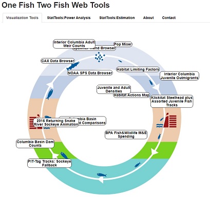
These draft tools create visualizations of Coordinated Assessments Partnership (CAP) Fish HLIs and other related data. The visualizations are concepts developed by BPA to support QA/QC processes and management applications, using a recent snapshot of available data. The data displayed are from CAP Fish HLIs, NOAA Fisheries’ Salmon Population Summary database, and BPA contractors provided directly to BPA outside the CAP but using similar standards. Explore these tools using the below links:
- OneFishTwoFish visualization tool
- BPA’s NOAA-Fisheries SPS data browser, which visualizes NOAA Fisheries’ annual viable salmonid population (VSP) time series data relative to Endangered Species Act (ESA) performance targets and helps show what data NOAA may have used in the most recent consultation
- BPA’s CAX data browser, which visualizes CAP Fish HLI time series data relative to ESA performance targets
- BPA’s spawner trend browser, which displays trends of salmonid spawner population sizes and evolutionarily significant units (ESUs)/distinct population segments (DPSs) using the most current data from various data sources
BPA’s CBFish.org
BPA’s CBFish.org is an interactive site that provides the public with an unprecedented view into BPA’s implementation of the Columbia Basin Fish & Wildlife Program, which spans a four-state region and is the largest environmental program of its kind in the world. Developed by the Northwest Power and Conservation Council pursuant to the Northwest Electric Power Planning and Conservation Act of 1980, the Program promotes measures for the purpose of protecting, mitigating, and enhancing fish and wildlife, including related spawning grounds and habitat, on the Columbia River and its tributaries.
CBFish.org includes project proposals from fiscal year 2007 forward, and budget adjustments from 2004 forward. To begin using the site, click on the green Explore menu in the upper left-hand corner. If you have questions or comments, CBFish.org always welcomes your feedback.
 The Northwest Power and Conservation Council (NPCC) ensures, with public participation, an affordable and reliable energy system while enhancing fish and wildlife in the Columbia River Basin.
Data Tools
Program Performance & Progress
Explore the NPCC’s Program Performance & Progress tool for a quick overview of the program and its accomplishments, including those related to fish and habitat. This tool provides links to more in-depth visual stories about Program mitigation and partners’ efforts, as well as to the Program Tracker tool, which will serve as the hub of the Program’s supporting information to track progress toward its goals, objectives, and strategy performance indicators.
Program Tracker (in development)
The NPCC’s Program Tracker will be a central portal to access information from program projects and partners that together provide an understanding of the status of the Columbia River Basin and program progress in mitigating the impacts of the hydrosystem.
The Program Tracker will also be the central tool that supports information used in the Council’s Program Performance & Progress and other Resource Tools and Maps. Once developed, the tool will be available from the Resource Tools and Maps landing page.
Resource Tools and Maps
The NPCC has developed a suite of interactive tools referred to as Resource Tools and Maps to provide Program information to the public and decision-makers. You will find operation and maintenance maps for Program-funded artificial production programs, fish screens, and lands. There is species-specific information about fish objectives in the Columbia River Basin. Subbasin and species dashboards provide access to key elements of the subbasin plans, including factors limiting each species and projects being implemented to benefit those species and their habitats. You can also view the NPCC’s high-level indicators adopted to track the progress of fish and wildlife efforts in the Columbia River Basin. (The high-level indicators site will be integrated into the new Program Tracker over time.)
![]() Pacific Northwest Aquatic Monitoring Partnership (PNAMP) is a forum to facilitate collaboration around aquatic monitoring topics of interest, promote best practices for monitoring, and encourage coordination and integration of monitoring activities as appropriate. The forum’s activities are conducted by participant working groups and teams as endorsed by the partner-based steering committee. The coordinating staff enhance and support PNAMP collaboration on topics of importance.
Pacific Northwest Aquatic Monitoring Partnership (PNAMP) is a forum to facilitate collaboration around aquatic monitoring topics of interest, promote best practices for monitoring, and encourage coordination and integration of monitoring activities as appropriate. The forum’s activities are conducted by participant working groups and teams as endorsed by the partner-based steering committee. The coordinating staff enhance and support PNAMP collaboration on topics of importance.
Data Tools
Monitoring Resources
Monitoring Resources is a website that provides an online, publicly accessible suite of information and tools, including maps and metadata describing existing monitoring projects; a library of standard monitoring methods, protocols, and data dictionaries; and guidelines and tools to help managers develop new monitoring programs and share existing ones.
Monitoring Explorer
Monitoring Explorer is a component of MonitoringResources.org and provides an interactive map viewer that displays where, when, and how various projects have collected data. Users can search for and display sample sites and their associated metadata.
The Salmon Data Mobilis/zation group is an international group dedicated to the salmon research and monitoring community which will aim to accelerate the uptake of interoperable methods and data from research, management, and monitoring, so as to empower the community to further develop the mechanistic understanding of what drives salmon declines, and importantly develop methods to counter the declines. More information can be found at Salmon Data Mobiliszation – Home, Salmon Research and Monitoring IG Feed, and Salmon Data Mobiliszation · GitHub.