Standards and Processes
StreamNet Program provides access to standardized data to inform regional assessments, reports, and decision-making processes. This necessitates that quality assurance (QA) and quality control (QC) standards are met, while the best available information is clearly communicated. The StreamNet Quality Assurance and Quality Control Plan was developed to ensure that the quality of the data satisfies the needs of the National Oceanic and Atmospheric Administration Fisheries (NOAA), Bonneville Power Administration (BPA), Northwest Power and Conservation Council (NPCC), U.S. Fish and Wildlife Service (USFWS), and other data consumers.
Data exchange standards, a data sharing agreement, and
rigorous QA/QC protocols are all part of the data compilation and reporting
process (see Data
Exchange Tools webpage and StreamNet Quality
Assurance and Quality Control Plan. Data, including reference documents, in
the StreamNet and CAX databases must conform to the StreamNet DES and CA HLI
DES documents, which precisely defines the data elements, their organization in
tables, and required formats. This document serves as the common denominator
for the specific data types contained in the database. Adherence to the DES
document assures that data can be loaded into the database, can be queried
accurately, and are equivalent for further analysis by users. Conversion of
agency data to the DES document and assuring that they conform before
submission is the responsibility of the project’s data stewards/compilers in
the data source agencies. Additions or changes to the DES are made following a
formal documented procedure adopted by the Steering Committee (see the latest
version from the CAP DDT document table Data Exchange Standard
Development and Revision Procedures for details).
QA procedures are applied at the agency data steward
level. An automated data validation and loading system has been implemented at
StreamNet. This system provides real-time feedback on the success (or not) of
data validation. Data are submitted to the StreamNet database one record at a
time, and real-time data validation is run on them at three levels. First, each
field has its own set of rules. Examples include ensuring numeric fields do not
contain text, ensuring codes fall within the group of allowable values, and
ensuring text strings are within acceptable length ranges. The second level of
validation ensures that values in the different fields within a table are
compatible. For example, if a record is submitted that says it is for “spring
run coho salmon,” the record is rejected because there is no such run. The
third level of validation looks for data problems between rows of data within a
table. This third level prevents duplicate data by enforcing all candidate keys
for a table. A useful feature of the automated validation routines is that the
data may be run against the validation rules and an error report obtained
without submitting the data for inclusion in the database. This feature allows
data submitters to check entire sets of data, fix all errors, and then submit
an entire data set after it is known it will pass validation. The interface
used for data submittals allows for new records, changing existing records, and
deleting existing records.
The StreamNet Quality Assurance and Quality Control Plan is periodically updated as needed, with current and previous versions found in the All Documents table.
To facilitate querying data available for anadromous and resident fish species, StreamNet Program has adopted a naming convention used in its query tools. American Fisheries Society (AFS) standards for capitalization are followed.
Natural populations:
Follow the formula for names already in use for other populations/superpopulations.
https://www.streamnet.org/cap/current-hli/current-pop/
Hatchery stocks:
Stock designations may also identify wild-origin adults collected in hatchery facilities or for hatchery operations. Stock names without a “wild” designation indicate a hatchery or mixed stock type.
Hatchery stock names and natural population names use this naming convention:
- Names use the form <source location(s)> <dash> [wild ]<run(s)> <species>. For example, “Big Creek – winter Steelhead”.
- Include specifiers such as “River” and “Creek” in the name.
- Use hyphens where necessary, such as for “mid-Columbia”.
- Use “and” for multiple locations; use ampersand for multiple runs.
- Capitalization: The first word, and proper nouns, are capitalized; other words are not. AFS considers accepted common names to be proper nouns, e.g. “Bull Trout”, “Coho Salmon”.
- Do the best possible for complex instances where the rules cannot apply perfectly. (This mostly applies to superpopulations.)
- Clarifying information goes in parentheses; information in addition to the name goes in square brackets.
- E.g. “Big Creek (near Alsea) – fall Coho Salmon”; “Burnt River – spring Chinook Salmon [extirpated]”.
The StreamNet Executive Committee members approved during their November 2023 meeting having the StreamNet Program adopt the process recommended by the PNAMP Fish Monitoring Work Group’s Fish Management Units Boundaries and Attributes Task Team. Below is the process as approved:
Recommended methods for defining fish management units (e.g., population, core area, migratory corridor), names, and boundaries for more effective, standardized analyses, and communication/display of data via the StreamNet data tools and GIS layers.
Define Fish Management Unit Boundaries that are inclusive of official designations (e.g., USFWS or NOAA recovery planning units) and reflect the existing species distribution knowledge
- Leverage StreamNet’s best available Generalized Fish Distribution dataset for the species of interest (e.g., bull trout). Overlay this dataset with the best available Watershed Boundary Dataset (sixth level HUCs 170602010101) to identify and attribute those sub-watersheds for which the partnership has identified species presence and habitat use type (where available). This collection of sub-watersheds defines the current or ‘probable native range’ for the species based on StreamNet’s fish distribution dataset (see figure 1) including all primary use types (e.g. migratory corridors).
- Obtain the best available, official management/recovery planning units from the authoritative agency, particularly when a listed species is involved. For example, the USFWS maintains a dataset that designates bull trout ‘core areas’ and ‘local populations’. Use these layers to expand and further attribute the selection of sixth level HUCs to track the official fish management unit types that they encompass (e.g. spawning and rearing). Fortunately, the USFWS and NOAA have generally followed a practice of using the Watershed Boundary Dataset as the primary source for geometry when defining such units, so the spatial relationship tends to be clean.
- For purposes of supporting regionwide display and filtering of data, we recommend not splitting HUC units to create a precise fit with established management units. Since the purpose of the boundaries in our use case is to support standardized filtering and display of data on multiple species and subspecies across the landscape, we instead recommend tracking exceptional cases of a fractional ‘fit’ through attribution. Additionally, the lines of distribution more precisely delineate extents within HUCs.
- Combine the boundary units defined by step (i) and (ii) above (see figure 2). These polygons will serve as the building blocks that will define the fish management units to be coded with standardized names and fish unit type
Define Fish Management Unit IDs, Names and Attributes by using the collection of polygons and associated attributes from step 1 above and further standardize and assign unit IDs, Names, and Type attributes while also tracking feature level metadata (e.g., data source, audit fields).
- Fish Management Unit IDs: A unique identifier will be needed for each unit. The specifics of how an ID is assigned and managed will be left to the implementation phase. One option would be to mimic and build upon the existing ‘population’ table from the Coordinated Assessments DES, recognizing that a population could be considered a type of fish management and/or analysis unit.
- Fish Management Unit Names: Establish a standardized convention for assigning Names to each Unit Type.
- Where a Unit is Official: Retain the official name from the authoritative source (e.g., bull trout core area or local population names as defined by the USFWS).
- Where a Unit is being created based on fish distribution: Follow a convention like that used to define population names in the StreamNet population table (see Appendix E of Coordinated Assessments DES).
- Fish Management Unit Type: What is appropriate here will vary by species and lead management agency. Examples below are for bull trout.
- Where a Unit is Official: Retain the official unit type designation from the authoritative source (e.g., core area, local population, potential population, etc. – as defined by the USFWS).
- Where a Unit is being created based on fish distribution: Follow a convention that characterizes the unit based on the primary use type values from the distribution data. In the bull trout example, we anticipate using a decision tree to incorporate and attribute migratory corridor or foraging areas, units with an unknown use type values (may warrant review by biologists), and those that include other non-migratory use types but that have no official unit type designation (may also warrant review by biologists).
- Other attributes from the source input layers may be carried forward during implementation and may vary by However, there will be a standardized, core set of attributes across all taxa. Feature level metadata will help track the source lineage of geometry, attributes and edit history.
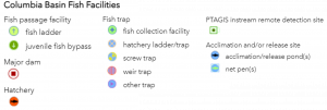
To facilitate user understanding and interoperability across PSMFC systems, the PSMFC GIS Center coordinates and maintains a regional ‘fish facilities’ dataset to serve as a point of integration across multiple Columbia Basin projects administered by the Commission (StreamNet, PTAGIS, RMIS, and others).
It is recommended that maps displaying these fish facilities use the same symbols as on the PSMFC Fish Facilities mapper: